Файл:Nasa world wind - teneriffa.jpg

Памер прагляду: 800 × 599 піксэлаў. Іншыя разрозьненьні: 320 × 240 піксэлаў | 640 × 479 піксэлаў | 1024 × 766 піксэлаў | 1280 × 958 піксэлаў.
Арыгінальны файл (1280 × 958 піксэляў, памер файла: 120 кб, тып MIME: image/jpeg)
Гісторыя файла
Націсьніце на дату/час, каб паглядзець, як тады выглядаў файл.
| Дата і час | Мініятура | Памеры | Удзельнік | Камэнтар | |
|---|---|---|---|---|---|
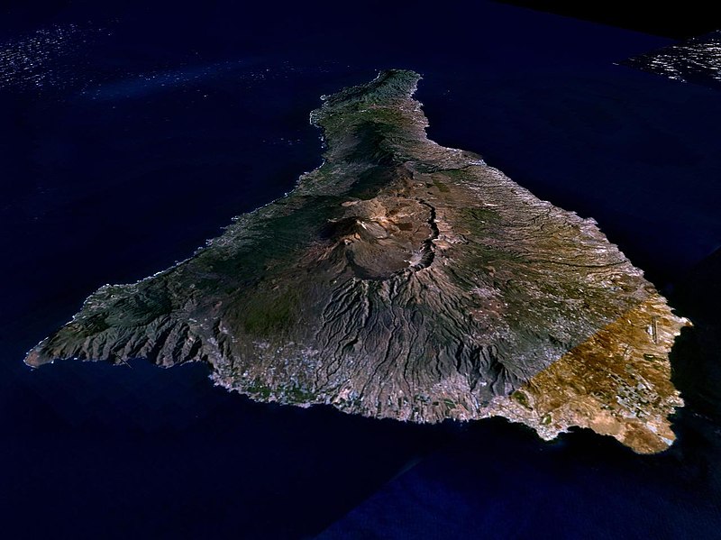
| цяперашняя | 04:15, 31 сакавіка 2005 |  | 1280 × 958 (120 кб) | Simplicius | {{NASA-PD}} Teneriffa from the west side. One sees Teide (3,700 meters) and the Caldera (2,000 m). To the right hand the new airport. On the left side one sees that there is more humidity and therefore vegetation at the north side of the island. |
Выкарыстаньне файла
Наступная старонка выкарыстоўвае гэты файл:
Глябальнае выкарыстаньне файла
Гэты файл выкарыстоўваецца ў наступных вікі:
- Выкарыстаньне ў ar.wikipedia.org
- Выкарыстаньне ў cs.wikipedia.org
- Выкарыстаньне ў de.wikipedia.org
- Выкарыстаньне ў de.wikinews.org
- Выкарыстаньне ў de.wikivoyage.org
- Выкарыстаньне ў en.wiktionary.org
- Выкарыстаньне ў eo.wikipedia.org
- Выкарыстаньне ў es.wikipedia.org
- Выкарыстаньне ў fa.wikipedia.org
- Выкарыстаньне ў fi.wikipedia.org
- Выкарыстаньне ў frr.wikipedia.org
- Выкарыстаньне ў fy.wikipedia.org
- Выкарыстаньне ў gl.wikipedia.org
- Выкарыстаньне ў he.wikipedia.org
- Выкарыстаньне ў hu.wikipedia.org
- Выкарыстаньне ў incubator.wikimedia.org
- Выкарыстаньне ў it.wikipedia.org
- Выкарыстаньне ў mn.wikipedia.org
- Выкарыстаньне ў nn.wikipedia.org
- Выкарыстаньне ў no.wikipedia.org
- Выкарыстаньне ў pl.wiktionary.org
- Выкарыстаньне ў ru.wikipedia.org
- Выкарыстаньне ў sh.wikipedia.org
- Выкарыстаньне ў sk.wikipedia.org
- Выкарыстаньне ў sw.wikipedia.org
- Выкарыстаньне ў tr.wikipedia.org
- Выкарыстаньне ў uk.wikipedia.org
- Выкарыстаньне ў vi.wikivoyage.org
- Выкарыстаньне ў zgh.wikipedia.org

